
Where We Be
| | | | | | |
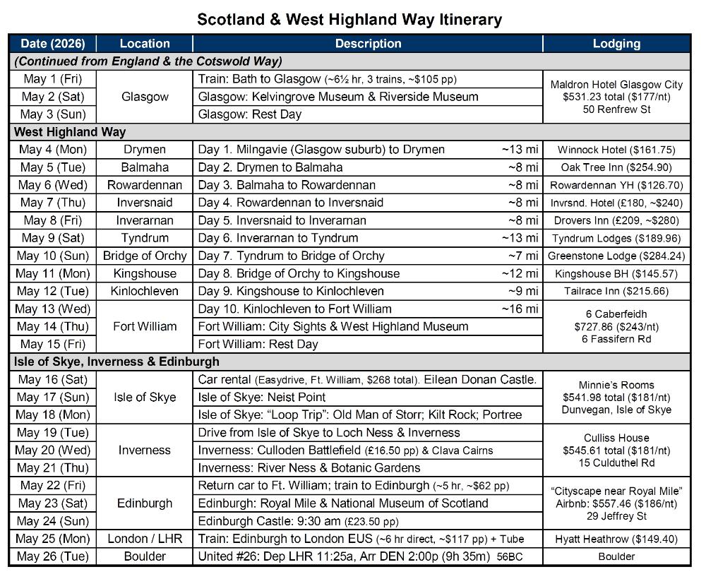
| West Highland Way -- Map & Itinerary |
The West Highland Way is a 96-mile trek from
the lowlands to the highlands of Scotland.
Those are the official numbers, although our
own AllTrails results came in closer to 102 miles.
Getting to the start of the hike is easy. Multiple
trains per day run between Glasgow's Queen
Street Station and Milngavie Station. (Milngavie
is pronounced "mull-GUY.") The ride only takes
about 25 minutes and costs £5. From Milngavie
train station, it's an easy 5-minute walk to the
start of the West Highland Way.
We highly recommend using a baggage transfer
service for this hike. We used AMS Scotland
and they were amazing, always getting our bag
where it needed to be in a timely manner. I kept
my own bag, but offloaded all the heavy stuff
into Robin's -- so mine was essentially a daybag.
If you plan to drive around the Highlands after
your hike, we recommend EasyDrive car rental
agency in Fort William. The cost for a one-week
rental was very reasonable, and they made the
check-in and return process straightforward.
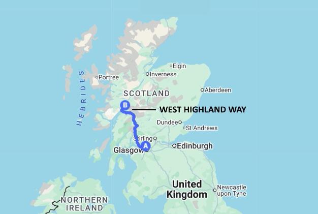
| This map shows where the West Highland Way is in relation to Scotland and England as a whole |
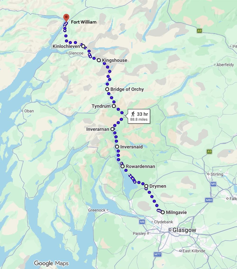
| West Highland Way: Detailed Map |
| This map shows all of our West Highland Way stopping points except one. (Balmaha is missing, between Drymen and Rowardennan, because Google Maps only allows ten "destinations" per map.) The itinerary below shows the estimated distances of each leg of the hike, based on our AllTrails results. |
| Map Data 2026 Google |
| Map Data 2026 Google |